Non corrigé
Uncorrected
CR 2022/27
International Court Cour internationale
of Justice de Justice
THE HAGUE LA HAYE
YEAR 2022
Public sitting
held on Wednesday 7 December 2022, at 4.30 p.m., at the Peace Palace,
President Donoghue, presiding,
in the case concerning Question of the Delimitation of the Continental Shelf between Nicaragua and Colombia beyond 200 nautical miles from the Nicaraguan Coast (Nicaragua v. Colombia)
____________________
VERBATIM RECORD
____________________
ANNÉE 2022
Audience publique
tenue le mercredi 7 décembre 2022, à 16 h 30, au Palais de la Paix,
sous la présidence de Mme Donoghue, présidente,
en l’affaire relative à la Question de la délimitation du plateau continental entre le Nicaragua et la Colombie au-delà de 200 milles marins de la côte nicaraguayenne (Nicaragua c. Colombie)
________________
COMPTE RENDU
________________
- 2 -
Present: President Donoghue
Vice-President Gevorgian
Judges Tomka
Abraham
Bennouna
Yusuf
Xue
Sebutinde
Bhandari
Robinson
Salam
Iwasawa
Nolte
Charlesworth
` Brant
Judges ad hoc McRae
Skotnikov
Registrar Gautier
- 3 -
Présents : Mme Donoghue, présidente
M. Gevorgian, vice-président
MM. Tomka
Abraham
Bennouna
Yusuf
Mmes Xue
Sebutinde
MM. Bhandari
Robinson
Salam
Iwasawa
Nolte
Mme Charlesworth,
M. Brant, juges
MM. McRae
Skotnikov, juges ad hoc
M. Gautier, greffier
- 4 -
The Government of the Republic of Nicaragua is represented by:
H.E. Mr. Carlos José Argüello Gómez, Permanent Representative of the Republic of Nicaragua to the international organizations based in the Kingdom of the Netherlands, Member of the International Law Commission,
as Agent and Counsel;
Mr. Alex Oude Elferink, Director, Netherlands Institute for the Law of the Sea, Professor of International Law of the Sea, Utrecht University,
Mr. Vaughan Lowe, K.C., Emeritus Chichele Professor of Public International Law, University of Oxford, member of the Institut de droit international, member of the Bar of England and Wales,
Mr. Alain Pellet, Emeritus Professor of the University Paris Nanterre, former Chairman of the International Law Commission, President of the Institut de droit international,
as Counsel and Advocates;
Ms Claudia Loza Obregon, Legal Adviser, Ministry of Foreign Affairs of the Republic of Nicaragua,
Mr. Benjamin Samson, PhD, Centre de droit international de Nanterre (CEDIN), University Paris Nanterre,
as Assistant Counsel;
Mr. Robin Cleverly, MA, DPhil, CGeol, FGS, Law of the Sea Consultant, Marbdy Consulting Ltd,
as Scientific and Technical Adviser;
Ms Sherly Noguera de Argüello, Consul General of the Republic of Nicaragua,
as Administrator.
- 5 -
Le Gouvernement de la République du Nicaragua est représenté par :
S. Exc. M. Carlos José Argüello Gómez, représentant permanent du Nicaragua auprès des organisations internationales basées au Royaume des Pays-Bas, membre de la Commission du droit international,
comme agent et conseil ;
M. Alex Oude Elferink, directeur de l’Institut néerlandais du droit de la mer, professeur de droit international maritime à l’Université d’Utrecht,
M. Vaughan Lowe, K.C., professeur émérite de droit international public (chaire Chichele) à l’Université d’Oxford, membre de l’Institut de droit international, membre du barreau d’Angleterre et du Pays de Galles,
M. Alain Pellet, professeur émérite de l’Université Paris Nanterre, ancien président de la Commission du droit international, membre de l’Institut de droit international,
comme conseils et avocats ;
Mme Claudia Loza Obregon, conseillère juridique au ministère des affaires étrangères de la République du Nicaragua,
M. Benjamin Samson, docteur en droit, Centre de droit international de Nanterre (CEDIN), Université Paris Nanterre,
comme conseils adjoints ;
M. Robin Cleverly, MA, DPhil, CGeol, FGS, consultant en droit de la mer, Marbdy Consulting Ltd,
comme conseiller scientifique et technique ;
Mme Sherly Noguera de Argüello, consule générale de la République du Nicaragua,
comme administratrice.
- 6 -
The Government of the Republic of Colombia is represented by:
H.E. Mr. Eduardo Valencia-Ospina, former Registrar and Deputy-Registrar of the International Court of Justice, member and former Special Rapporteur and Chairman of the International Law Commission,
as Agent and Counsel;
H.E. Ms Carolina Olarte-Bácares, Ambassador of the Republic of Colombia to the Kingdom of the Netherlands,
H.E. Ms Elizabeth Taylor Jay, former Ambassador of Colombia to Kenya, former Permanent Representative of Colombia to the United Nations Environment Programme and the United Nations Human Settlements Programme,
as Co-Agents;
H.E. Mr. Álvaro Leyva Durán, Minister for Foreign Affairs of the Republic of Colombia,
H.E. Mr. Everth Hawkins Sjogreen, Governor of San Andrés, Providencia and Santa Catalina, Colombia,
as National Authorities;
Mr. W. Michael Reisman, Myres S. McDougal Professor Emeritus of International Law, Yale University, member of the Institut de droit international,
Sir Michael Wood, KCMG, member of the International Law Commission, member of the Bar of England and Wales,
Mr. Rodman R. Bundy, former avocat à la Cour d’appel de Paris, member of the Bar of the State of New York, partner at Squire Patton Boggs LLP, Singapore,
Mr. Jean-Marc Thouvenin, Professor at the University Paris Nanterre, Secretary-General of the Hague Academy of International Law, associate member of the Institut de droit international, member of the Paris Bar, Sygna Partners,
Ms Laurence Boisson de Chazournes, Professor of International Law and International Organization, University of Geneva, Professor, Collège de France (2022-2023), member of the Institut de droit international,
Mr. Lorenzo Palestini, PhD, Lecturer at the Graduate Institute of International and Development Studies and at the University of Geneva,
as Counsel and Advocates;
Mr. Andrés Villegas Jaramillo, LLM, Co-ordinator, Group of Affairs before the International Court of Justice at the Ministry of Foreign Affairs of Colombia, association of the Instituto Hispano-Luso-Americano de Derecho Internacional,
Mr. Makane Moïse Mbengue, Professor at the University of Geneva, Director of the Department of Public International Law and International Organization, associate member of the Institut de droit international,
Mr. Eran Sthoeger, Esq., Adjunct Professor of International Law at Brooklyn Law School and Seton Hall Law School, member of the Bar of the State of New York,
- 7 -
Le Gouvernement de la République de Colombie est représenté par :
S. Exc. M. Eduardo Valencia-Ospina, ancien greffier et ancien greffier adjoint de la Cour internationale de Justice, membre et ancien rapporteur spécial et président de la Commission du droit international,
comme agent et conseil ;
S. Exc. Mme Carolina Olarte-Bácares, ambassadrice de la République de Colombie auprès du Royaume des Pays-Bas,
S. Exc. Mme Elizabeth Taylor Jay, ancienne ambassadrice de la Colombie auprès du Kenya et ancienne représentante permanente de la Colombie auprès du Programme des Nations Unies pour l’environnement et du Programme des Nations Unies pour les établissements humains,
comme coagentes ;
S. Exc. M. Álvaro Leyva Durán, ministre des affaires étrangères de la République de Colombie,
S. Exc. M. Everth Hawkins Sjogreen, gouverneur de San Andrés, Providencia et Santa Catalina, Colombie,
comme autorités nationales ;
M. W. Michael Reisman, professeur émérite de droit international à l’Université de Yale, titulaire de la chaire Myres S. McDougal, membre de l’Institut de droit international,
Sir Michael Wood, KCMG, membre de la Commission du droit international, membre du barreau d’Angleterre et du pays de Galles,
M. Rodman R. Bundy, ancien avocat à la cour d’appel de Paris, membre du barreau de l’Etat de New York, associé au cabinet Squire Patton Boggs, LLP (Singapour),
M. Jean-Marc Thouvenin, professeur à l’Université Paris Nanterre, secrétaire général de l’Académie de droit international de La Haye, membre associé de l’Institut de droit international, membre du barreau de Paris, cabinet Sygna Partners,
Mme Laurence Boisson de Chazournes, professeure de droit international et organisation internationale à l’Université de Genève, professeure au Collège de France (2022-2023), membre de l’Institut de droit international,
M. Lorenzo Palestini, PhD, chargé d’enseignement à l’Institut de hautes études internationales et du développement et à l’Université de Genève,
comme conseils et avocats ;
M. Andrés Villegas Jaramillo, LLM, coordonnateur du groupe chargé des affaires portées devant la Cour internationale de Justice au sein du ministère des affaires étrangères de la Colombie, membre associé de l’Instituto Hispano-Luso-Americano de Derecho Internacional,
M. Makane Moïse Mbengue, professeur à l’Université de Genève, directeur du département de droit international public et organisation internationale, membre associé de l’Institut de droit international,
M. Eran Sthoeger, Esq., professeur adjoint de droit international à la Brooklyn Law School et à la Seton Hall Law School, membre du barreau de l’Etat de New York,
- 8 -
Mr. Alvin Yap, Advocate and Solicitor of the Supreme Court of Singapore, Squire Patton Boggs LLP, Singapore,
Mr. Gershon Hasin, JSD, Visiting Lecturer in Law at Yale University,
Mr. Gabriel Cifuentes, PhD, adviser to the Minister for Foreign Affairs of the Republic of Colombia,
as Counsel;
Ms Jenny Bowie Wilches, First Secretary, Embassy of the Republic of Colombia in the Kingdom of the Netherlands,
Ms Viviana Andrea Medina Cruz, Second Secretary, Embassy of the Republic of Colombia in the Kingdom of the Netherlands,
Mr. Raúl Alfonso Simancas Gómez, Third Secretary, Embassy of the Republic of Colombia in the Kingdom of the Netherlands,
Mr. Oscar Casallas Méndez, Third Secretary, Group of Affairs before the International Court of Justice,
Mr. Carlos Colmenares Castro, Third Secretary, Group of Affairs before the International Court of Justice,
Ministry of Foreign Affairs of the Republic of Colombia;
Rear Admiral Ernesto Segovia Forero, Chief of Naval Operations,
CN Hermann León, Delegate of Colombia to the International Maritime Organization,
CN William Pedroza, National Navy of Colombia, Director of Maritime and Fluvial Interests Office,
Navy of the Republic of Colombia;
Mr. Lindsay Parson, Geologist, Director of Maritime Zone Solutions Ltd, United Kingdom, former member and Chair of the United Nations International Seabed Authority’s Legal and Technical Commission,
Mr. Peter Croker, Geophysicist, Consultant at The M Horizon (UK) Ltd, former Chair of the United Nations Commission on the Limits of the Continental Shelf,
Mr. Walter R. Roest, Geophysicist, Director of Roest Consultant EIRL, France, member of the United Nations Commission on the Limits of the Continental Shelf,
Mr. Scott Edmonds, Cartographer, Director of International Mapping,
Mr. Thomas Frogh, Cartographer, International Mapping,
as Technical Advisers.
- 9 -
M. Alvin Yap, avocat et solicitor à la Cour suprême de Singapour, cabinet Squire Patton Boggs, LLP (Singapour),
M. Gershon Hasin, JSD, chargé d’enseignement en droit invité à l’Université de Yale,
M. Gabriel Cifuentes, PhD, conseiller auprès du ministre des affaires étrangères de la République de Colombie,
comme conseils ;
Mme Jenny Bowie Wilches, première secrétaire, ambassade de la République de Colombie au Royaume des Pays-Bas,
Mme Viviana Andrea Medina Cruz, deuxième secrétaire, ambassade de la République de Colombie au Royaume des Pays-Bas,
M. Raúl Alfonso Simancas Gómez, troisième secrétaire, ambassade de la République de Colombie au Royaume des Pays-Bas,
M. Oscar Casallas Méndez, troisième secrétaire, groupe chargé des affaires portées devant la Cour internationale de Justice,
M. Carlos Colmenares Castro, troisième secrétaire, groupe chargé des affaires portées devant la Cour internationale de Justice,
ministère des affaires étrangères de la République de Colombie ;
Le contre-amiral Ernesto Segovia Forero, chef des opérations navales,
Le capitaine de vaisseau Hermann León, représentant de la Colombie auprès de l’Organisation maritime internationale,
Le capitaine de vaisseau William Pedroza, marine nationale de Colombie, chef de la direction chargée des intérêts maritimes et fluviaux,
marine de la République de Colombie ;
M. Lindsay Parson, géologue, directeur de Maritime Zone Solutions Ltd (Royaume-Uni), ancien membre et président de la commission technique et juridique de l’Autorité internationale des fonds marins des Nations Unies,
M. Peter Croker, géophysicien, consultant auprès de The M Horizon (UK) Ltd, ancien président de la Commission des limites du plateau continental des Nations Unies,
M. Walter R. Roest, géophysicien, directeur de Roest Consultant EIRL, France, membre de la Commission des limites du plateau continental des Nations Unies,
M. Scott Edmonds, cartographe, directeur de International Mapping,
M. Thomas Frogh, cartographe, International Mapping,
comme conseillers techniques.
- 10 -
The PRESIDENT: Please be seated. The sitting is open.
The Court meets this afternoon to hear the second round of oral argument of the Republic of Nicaragua. I shall now give the floor to Professor Vaughan Lowe. You have the floor, Professor.
Mr. LOWE: Thank you, Madam.
UNDER CUSTOMARY INTERNATIONAL LAW, A STATE’S ENTITLEMENT TO A CONTINENTAL SHELF BEYOND 200 NAUTICAL MILES FROM THE BASELINES FROM WHICH THE BREADTH OF ITS TERRITORIAL SEA IS MEASURED MAY EXTEND WITHIN 200 NAUTICAL MILES FROM THE BASELINES OF ANOTHER STATE
1. Madam President, Members of the Court, the submissions in this case on Monday and Tuesday leave the impression that the Parties are not completely on the same wavelength. Two propositions, stated on several occasions by Colombia yesterday, illustrate the point. Colombia said “this is not a delimitation case”1, and it referred (in the English translation of Professor Thouvenin’s speech) to the “invasion” and the “penetration”2 of Colombia’s 200-nautical-mile zone by Nicaragua’s natural prolongation, rather like giant knotweed invading a garden.
2. That is not at all how Nicaragua sees this case. Let me have another go at explaining Nicaragua’s position, and let me use Colombia’s map at tab 42 from yesterday’s folder to illustrate it. The map is said to represent in blue light blue, dark blue: it does not matter the continental shelf of coastal States. It does not matter whether the claim is based on a 200-nautical-mile criterion or on natural prolongation. All of the blue areas are continental shelf, according to the submissions of coastal States to the Commission on the Limits of the Continental Shelf —the CLCS, the body that the UNCLOS States parties established to review their determinations of the locations of the outer edge of the continental shelf as defined by UNCLOS, Article 76. The white areas are the international sea-bed area.
3. The map illustrates three points about Nicaragua’s case. First, the CLCS is concerned with the outer limit, the boundary between the blue areas and the white areas, the boundary between the continental shelf of coastal States and the international sea-bed area. In the words of Article 3 of Annex II of UNCLOS, it is the function of the Commission “to consider the data and other material
1 CR 2022/26, p. 11, para. 6 (Argüello Gómez).
2 CR 2022/26, p. 52, para. 14, and p. 60, para. 49 (Thouvenin); p. 61, paras. 3 and 5 (Boisson de Chazournes).
- 11 -
submitted by coastal States concerning the outer limits of the continental shelf in areas where those limits extend beyond 200 nautical miles, and to make recommendations”.
4. The CLCS is not concerned with the situation inside the blue areas. Colombia’s references yesterday to the debates at the Law of the Sea Conference emphasized that point. And the point is underlined by the provisions of Article 76 of UNCLOS.
5. Article 76 (1) defines the continental shelf as
“the sea-bed and subsoil of the submarine areas that extend beyond its territorial sea throughout the natural prolongation of its land territory to the outer edge of the continental margin, or to a distance of 200 nautical miles from the baselines from which the breadth of the territorial sea is measured where the outer edge of the continental margin does not extend up to that distance”.
Then paragraphs 2 through 9, in Article 76, go on to elaborate on that definition and to explain how in practice the exact location of the “outer edge of the continental margin” is to be determined. Article 76 (10) then says: “The provisions of this article are without prejudice to the question of delimitation of the continental shelf between States with opposite or adjacent coasts.”
6. “Tell us about your outer limit”, says the CLCS, “we are not interested in questions of delimitation with opposite or adjacent coasts”. If the Court is looking for an explanation of why States do not notify the CLCS of overlaps between their continental shelf and those of neighbouring States, it need look no further. It is not any business of the CLCS. Professor Oude Elferink will return to this point shortly.
7. The second key point is that all of the blue areas consist of continental shelf. Whose continental shelf, we cannot tell from the map. The blue areas need to be delimited.
8. We do not say: “the continental shelf of State A is invading the maritime zone of State B”. All of the blue area is one continuous continental shelf and, until such time as there is a delimitation, one cannot speak properly of “State A’s continental shelf” or “State B’s continental shelf”. That simply begs the question. By definition, we do not know where one State’s shelf ends and the other State’s shelf starts, until the delimitation has taken place.
9. The point at the heart of Nicaragua’s case is that, just as it appears on the map, we are in the blue zone. There is a continuous continental shelf stretching throughout the Caribbean, as it stretches around all other coastal areas in the world. The delimitation lines need to be drawn in that blue zone. This is, precisely, a delimitation case.
- 12 -
10. There is a related point. All of the blue area is continental shelf, and the basis of title — distance or natural prolongation — is immaterial. But Colombia employs some tangled logic at this point, referring to the Libya/Malta case. Colombia says, correctly, that the geological or geomorphological characteristics of areas within 200 nautical miles of the baselines are completely immaterial to the question of the coastal State’s entitlement to a continental shelf. It is immaterial: those factors have no effect; they do not matter. The coastal State’s entitlement within the 200-nautical-mile zone arises whether or not the sea-bed is the natural prolongation of its land territory.
11. But it is a logical fallacy to infer from that that the conclusion is that the entitlement to a continental shelf that arises in respect of the natural prolongation of the land territory under the sea is no longer operative for the first 200 nautical miles of the natural prolongation, and then springs up into action once the 200-nautical-mile limit is reached.
12. Natural prolongation is a basis of title throughout the entire natural prolongation: but for the first 200 nautical miles, there is simply no need to refer to it, because the UNCLOS definition in Article 76 deems the sea-bed within 200 nautical miles, whether or not it is part of the natural prolongation of the coastal State’s land territory, to be continental shelf.
13. Colombia’s argument is like saying that it is immaterial whether Nicaragua has an entitlement to a continental shelf under UNCLOS, because it has such an entitlement under customary international law; and then drawing the inference from that that UNCLOS is not an effective basis of title for Nicaragua vis-à-vis other UNCLOS States. The fallacy is obvious. Nicaragua’s rights would depend upon both bases, customary international law and, as a basic matter of treaty law, UNCLOS itself.
14. The third point is that there is nothing at all unusual in all of this. Every maritime boundary drawn by this or any other international tribunal, or fixed by agreement between neighbouring States, has drawn delimitation lines in the blue zone. That is the inevitable consequence of having a continental shelf extending around all of the continents and land masses in the world. It is one continuous continental shelf, to be delimited between the coastal States that sit around it.
15. It is common ground that the continental shelf extends throughout the sea-bed adjacent to coastal States, out to the outer edge of the continental margin, or to a distance of 200 nautical miles
- 13 -
from the baselines in circumstances where the outer edge of the continental margin does not extend up to that distance. That is the definition in Article 76 which we all accept, and which the Court has ruled represents customary international law.
16. The methodology for delimitation is also common ground. The Court recorded Colombia’s position on this matter, and the Court’s statement of the law, in paragraphs 187-199 of its 2012 Judgment in the case concerning the Territorial and Maritime Dispute between Nicaragua and Colombia. The three-stage process is well known, and there is no need for me to rehearse it now.
17. The one point that I do wish to emphasize is that the criterion that is being implemented by the Court in applying this three-stage methodology is crucial. The aim — the legal requirement — is the achievement of an equitable solution. That is true both for continental shelf delimitation and for EEZ delimitation.
18. Colombia makes much of the unthinkable loss to States if they have anything less than their full 200-nautical-mile EEZ. Of course, States often do have less than 200 nautical miles. In semi-enclosed seas, such as the Caribbean and the Mediterranean, where States are less than 400 nautical miles apart, some, if not all, of them will necessarily get less than the full 200 nautical miles.
19. Again, Colombia’s argument is fallacious. It is only if one assumes that there can be no overlap between a continental shelf — an “outer continental shelf” — and an EEZ that Colombia’s position holds. And that, of course, is the very point in question. Nicaragua says they can overlap, and that there must be an equitable delimitation of the continental shelf. Colombia says that they cannot overlap and that a State must always be allowed to claim a full 200-nautical-mile EEZ even if it overlaps the continental shelf of another State. Whether or not that produces an “equitable solution” is irrelevant to Colombia.
20. That brings me back to the basic point with which I started on Monday. Colombia said yesterday that its first-round speeches were “intended to respond to the Court’s two questions and not to rebut at this stage the arguments made by Nicaragua”. And indeed, Colombia did ignore this and other points that we made on Monday.
- 14 -
21. The basic point is that the outrages and unfairness and chaos that Colombia rather flamboyantly attributes to Nicaragua’s position cannot arise. The result of the delimitation will by definition necessarily be a result that, in the view of the Court, produces an equitable solution.
22. As Nicaragua said in paragraph 5.57 of its Reply:
“the delimitation of overlapping continental shelf claims, whether based on distance or geological or gradient criteria under Article 76, are to be settled on a case-by-case basis in order to achieve an equitable solution in accordance with UNCLOS Article 83. The point is that stopping at or short of the 200 NM limit of another State does not necessarily secure an equitable solution in every case, so that it can be applied mechanically without regard to the specific circumstances in each case.”
23. It is in the context of identifying an equitable solution that factors such as Colombia’s claim that it must always have its full 200-nautical-mile entitlement, and Nicaragua’s submissions on the relative weight to be given to its mainland coast and to the tiny Colombian islands that Colombia wishes to use to cut off Nicaragua’s mainland projection, will fall to be considered.
24. Unless I can be of further assistance, Madam President, that completes my part of Nicaragua’s second-round submission. I would ask that you call Professor Oude Elferink to the lectern.
The PRESIDENT: I thank Professor Lowe. I now invite the next speaker, Professor Alex Oude Elferink, to address the Court. You have the floor, Professor.
Mr. OUDE ELFERINK: Thank you, Madam President.
SUBMISSIONS TO THE CLCS DO NOT PROVE COLOMBIA’S CONTENTION THAT THE CONTINENTAL SHELF BEYOND 200 NAUTICAL MILES OF ONE STATE CANNOT OVERLAP WITH THE 200-NAUTICAL-MILE ZONE OF ANOTHER STATE
1. Madam President, Members of the Court, it is my task today to address the significance of State practice in relation to submissions to the CLCS and how that practice is relevant to the first question the Court has asked the Parties to address.
2. Yesterday, Mr. Bundy took issue with counsel of Nicaragua for declining to discuss the issue of State practice during Nicaragua’s first round of pleading this Monday3. He then presented the Court with an extensive discussion of submissions States have made to the CLCS. Having
3 CR 2022/26, p. 32, para. 1 (Bundy).
- 15 -
listened attentively to his presentation, I cannot but conclude that his review of State practice was a futile exercise that did not really advance Colombia’s position. To the contrary, I would say. Let me explain why.
3. Madam President, at the outset Mr. Bundy highlighted four key points that emerged from his subsequent analysis4. However, he failed to mention one point that is critical to the assessment of State practice in relation to submissions to the CLCS and undercuts his whole argument.
4. This concerns Article 76, paragraph 10, of the Convention, which provides that “[t]he provisions of this article [that is Article 76] are without prejudice to the question of delimitation of the continental shelf between States with opposite or adjacent coasts”. Paragraph 10 covers the whole of Article 76, including its paragraph 8, which requires States to make a submission to the CLCS. Paragraph 10 implies that a State is not precluded from seeking a continental shelf delimitation with a neighbouring State because it has not submitted information to the CLCS on the outer limits of its continental shelf beyond 200 nautical miles that is within 200 nautical miles of that other State. And the resulting boundary would not be subject to review by the CLCS, because it is within 200 nautical miles from the baselines of one of the States concerned.
5. I could stop here. However, I will continue for two reasons. First, Mr. Bundy made a seemingly compelling presentation of State practice. “Seemingly” is the key provision in this connection. To dispel any lingering belief in the relevance of his presentation, I will discuss a number of examples he presented and a number of examples he did not mention.
6. Before doing so, let me anticipate one argument Colombia might seek to develop this Friday. Colombia might argue that my argument on Article 76, paragraph 10, is contradicted by the fact that a number of States have made submissions for areas that are within 200 nautical miles of another State. In the particular case of Nicaragua, it proceeded to making a full submission to the CLCS after the Court in its 2012 Judgment in Territorial and Maritime Dispute had observed that the information Nicaragua had submitted to the Court fell short of what was required of a full submission to the CLCS5. It may be observed that there is nothing in Article 76 that prohibits a State from making such a submission and States may have good reason to do so.
4 CR 2022/26, p. 34, para. 9 (Bundy).
5 2012 Judgment, p. 669, para. 127.
- 16 -
7. I now turn to Mr. Bundy’s discussion of CLCS submissions. Let me restart by referring to a couple of examples he did not mention. On screen we have a figure that is included in the information on the website of the CLCS on the submission of the Russian Federation to the Commission that was made in 20016. The shaded area in the Barents Sea on the left-hand side of the figure is a part of the Russian continental shelf that is beyond 200 nautical miles from the baselines of the Russian Federation. However, if we compare the area to the 200-nautical-mile limit of Norway, it becomes clear that the outer limits of the Russian Federation extend to within 200 nautical miles of the Norwegian baselines. On screen, we have the “Loop Hole” high seas area that Mr. Bundy also showed you. In red you now see the areas of the Russian continental shelf beyond 200 nautical miles that are within the Norwegian economic zone. These figures are at tabs AOE2-1 and AOE2-2 of the judges’ folder.
In its reaction to the Russian submission, Norway did not object to the Russian approach, but instead pointed to the fact that the whole area was the subject of ongoing negotiations on the delimitation of a bilateral boundary7.
8. Another case counsel for Colombia failed to mention is that of the French islands of Saint-Pierre and Miquelon, although this case is highly relevant for a number of reasons. The figure on screen is at tab AOE2-4 of the judges’ folder. First, the 200-nautical-limit of Saint-Pierre and Miquelon stops well within the 200-nautical-mile limit of Canada. The bilateral boundary is presented by the red line. Canada’s 200-nautical-mile limit that is due south of the seaward limit of that boundary is some 80 nautical miles distant from it. That notwithstanding, France made a submission to the CLCS in 2014. The outer limit contained in that submission is the broken green line on screen. In other words, France does not consider that its continental shelf has to stop at the point it enters the Canadian exclusive economic zone. Second, the French approach in this case implies that other submissions of France that do stop at the 200-nautical-mile limit do not do so
6 Available at https://www.un.org/depts/los/clcs_new/submissions_files/rus01/RUS_CLCS_….
7 Note Verbale of 20 March 2002 (available at https://www.un.org/depts/los/clcs_new/submissions_files/rus01/ CLCS_01_2001_LOS__NORtext.pdf) and in the judges’ folder (tab AOE2-7).
- 17 -
because France considers that there is a legal obligation to do so
8. I should also note that the delimitation of the 200-nautical-mile zones of France and Canada was the subject of an arbitration. In its award, the tribunal found it could not pronounce itself on the area beyond that limit. It added that not pronouncing itself on the delimitation of the continental shelf beyond the 200-nautical-mile limit of the French islands did not signify nor might be interpreted as prejudging, accepting or refusing the rights that France or Canada might claim to a continental shelf beyond 200 nautical miles9.
9. Mr. Bundy did discuss the full submission of Australia that it made in November of 200410. What he failed to discuss was the situation in the Timor Sea, although that is particularly pertinent to the matter he was considering. If one checks the Executive Summary of Australia’s full submission, there is no reference to the Timor Sea. And that is exactly the point. The figure that is now on screen, and at tab AOE2-6 of the judges’ folder illustrates why. The whole of the Timor Sea is within 200 nautical miles of the baselines of its coastal States. The figure identifies the 200-nautical-mile limits of Australia and Timor-Leste. The red and green lines. Apart from claiming a 200-nautical-mile zone, Australia maintained the position that its continental shelf extended up to the Timor Trough, which is within the 200-nautical-mile zone of Timor-Leste. As I just mentioned, the Timor Sea is not included in the Australian submission. We may conclude from this that Australia considers that a State is not required to make a submission to the CLCS in relation to its continental shelf beyond 200 nautical miles where it is located within 200 nautical miles of the baselines of another State. To save Colombia’s counsel the trouble of developing the argument that this is a concocted example, let me point out that Timor-Leste in any case did not consider that the Australian claim was a hypothetical one. In reaction to the Australian Executive Summary, Timor-Leste submitted a diplomatic Note, in which it among other observed: “it is Timor-Leste’s view that the CLCS should make clear in its recommendations that there is no question of endorsement of the
8 See Submission of France in respect of the areas of French Guiana and New Caledonia (Executive Summary available at https://www.un.org/depts/los/clcs_new/submissions_files/fra07/fra_execu…); and Submission of France in respect of French Polynesia (Executive Summary available at https://www.un.org/depts/los/clcs_ new/submissions_files/fra79_18/Part1_Summary_French_Polynesia_EN.pdf).
9 Case concerning the delimitation of maritime areas between Canada and France, Decision of 10 June 1992, United Nations, Reports of Arbitral Awards (RIAA), Vol. XXI, pp. 265-341 (French text only), paras 80 and 82. The relevant paragraphs are in the judges’ folder.
10 See CR 2022/26, p. 37, paras. 24 et seq.
- 18 -
Australian continental shelf entitlement beyond 200 nautical miles in the Timor Sea region”. The full text of Timor-Leste’s note is at tab AOE2-6 of the judges’ folder.
10. Mr. Bundy did discuss the Argo region, which is one of the ten areas for which Australia made a submission to the CLCS in 200411. Mr. Bundy referred to this as an area that lies between Australia and Indonesia12. However, in this case he did not give you the whole picture. Both literally and figuratively. On screen, we have a figure of the Argo region that is taken from the Executive Summary of Australia’s submission. It is at tab AOE2-8 of the judges’ folder. Not all of the information that is included in this figure is included in the figure of the Argo region that Mr. Bundy showed you yesterday13. Let me briefly explain what this figure illustrates, and Mr. Bundy’s figure did not. The outer limit of Australia’s continental shelf beyond 200 nautical miles on which information was submitted to the CLCS is identified by the pink line. That line stops at the 200-nautical-mile limit of Indonesia, which is identified by the light-blue line, to which we have added a label. However, to the north of the line is another line, which the legend to the figure identifies as “1997 treaty with Indonesia seabed boundary”14. Two things may be noted about that boundary. First, the continental shelf area it delimits is within 200 nautical miles of Indonesia, but the area concerned is partly beyond 200 nautical miles from Australia. To illustrate this latter point, we have now highlighted the latter area. Second, Australia did not make a submission on the outer limits beyond 200 nautical miles of this area to the Commission. It may furthermore be noted that this example undercuts Mr. Bundy’s argument that Indonesia holds that the continental shelf beyond 200 nautical miles of one State cannot extend into the 200-nautical-mile zone of another State15. In discussing Indonesia’s approach to Australia’s Christmas Island, he submitted that this example “reflects Indonesia’s opinio juris in respecting the 200-nautical-mile entitlements of neighbouring States even if those entitlements are generated by a small island”16. Indonesia’s treaty practice with
11 CR 2022/26, p. 38, para. 27.
12 CR 2022/26, p. 38, para. 27.
13 See judges’ folder, session of 6 Dec. 2022, tab 21, (RRB-1), Fig. 8.
14 Treaty between the Government of Australia and the Government of the Republic of Indonesia establishing an exclusive economic zone boundary and certain seabed boundaries, 14 March 1997 (not yet entered into force) (available at https://www.un.org/Depts/los/LEGISLATIONANDTREATIES/PDFFILES/TREATIES/A…).
15 See CR 2022/26, p. 38, para. 28.
16 See CR 2022/26, p. 38, para. 28.
- 19 -
Australia indicates that there is no such practice and the Indonesian opinio juris to the contrary reflects that a continental shelf beyond 200 nautical miles may extend into the exclusive economic zone of another State.
11. Another example Mr. Bundy provided that is in need of some contextualization is that involving Mozambique17. He was correct in pointing out that the outer limit of Mozambique as included in its submission in part is located at the 200-nautical-mile limit of the island of Europa. But the context was missing. First, there is the “without prejudice” clause contained in Article 76 (10) of the Convention. Mozambique’s submission is without prejudice to the delimitation of its continental shelf boundary with Europa. Second, the island of Europa is part of France. As I discussed previously, France, by making a submission in relation to Saint-Pierre and Miquelon, has expressed the legal position that a continental shelf beyond 200 nautical miles may extend into the exclusive economic zone of a neighbouring State. This French position was already in the public domain when Mozambique made its submission to the CLCS in 201018. Finally, should we really believe, as Colombia is submitting, that the Convention, which establishes an equitable order for the ocean, is intended to provide for a situation where a developing coastal State would have to accept that its entitlement to a continental shelf is seriously curtailed by the 200-nautical-mile zone of a small island that came under the control of a European Power as the result of European colonial expansion? Finally, let me mention some numbers in relation to this figure, which is at tab AOE2-9 of the judges’ folder. The island of Europa measures some 8 km in diameter, and the Mozambique coast that is opposite the island, and is identified by the blue line, measures 490 km: a ratio of approximately 1:60. Disproportionality writ large.
12. The final example of Mr. Bundy I would like to discuss concerns Ecuador. He concluded:
“Ecuador’s submission deliberately did not extend within 200 nautical miles of a neighbouring State’s baselines because that area was considered to be under that other State’s jurisdiction. This again reflects opinio juris.”19
17 See CR 2022/26, pp. 40-41, paras. 40-42 (Bundy).
18 See “Informations préliminaires indicatives sur la limite extérieure du plateau continental au-delà de 200 milles marins des lignes de base à partir desquelles est mesurée la largeur de la mer territoriale de Saint-Pierre-et-Miquelon”, available at https://www.un.org/depts/los/clcs_new/submissions_files/preliminary/fra… pierre_m.pdf.
19 CR 2022/26, p. 41, para. 45 (Bundy).
- 20 -
Unfortunately, he again failed to provide you with the relevant context, although the figure he showed you, and which is now on screen at tab AOE2-10 of the judges’ folder, did provide an indication that is hardly to be missed. For your information, we have highlighted the feature concerned. It is the maritime boundary between Ecuador and Peru delimiting their 200-nautical-mile zones extending from their mainland. By agreeing on that boundary, Ecuador and Peru delimited the extent of their respective 200-nautical-mile zones. In that light, I can agree with Mr. Bundy on one point. The submission of Ecuador reflects Ecuador’s opinio juris. However, not in the sense that a continental shelf boundary beyond 200 nautical miles cannot encroach upon the exclusive economic zone of another State as a matter of principle. Ecuador’s practice reflects the belief that pacta sunt servanda.
13. Madam President, that concludes my review of Mr. Bundy’s analysis of submissions to the CLCS. I hope you forgive me for making one final point in relation to his analysis before I will come to my conclusions. At the start of his presentation, he showed you a list of States that allegedly support Colombia’s argument and those that did not20. The result was staggering. Over 92 per cent of the cases that were listed supported his argument21. However, even if we were to ignore the relevance of Article 76, paragraph 10, of the Convention, which I discussed at the outset quod non this overblown figure is only achieved by miscategorizing numerous entries. For instance, three of France, Australia, three of Indonesia, the Russian Federation and Ecuador. Nine entries linked to the sample I discussed.
14. Madam President, I come to my conclusions. First, Mr. Bundy in his analysis of submissions to the CLCS completely overlooked the relevance of Article 76, paragraph 10, of the Convention. That paragraph accomplishes that submissions to the Commission are made without prejudice to the delimitation of the continental shelf between States with opposite or adjacent coasts. States may raise the issue of delimitation of their continental shelf beyond 200 nautical miles in relation to the 200-nautical-mile continental shelf of another State also in case they have not made a submission to the CLCS for such an area.
15. Second, the analysis of the submissions to the CLCS provided by counsel for Colombia is seriously flawed. My analysis of practice leads to two conclusions. First, in the light of the
20 See judges’ folder for the hearing of 6 Dec. 2022, tab 12 (RRB-1), fig. 1.
21 CR 2022/26, p. 34, para. 9 (Bundy).
- 21 -
implications of Article 76, paragraph 10, stopping an outer limit beyond 200 nautical miles at the 200-nautical-mile limit of another State does not reflect an opinio juris that the continental shelf cannot extend into the 200-nautical-mile zone of another State. Second, apart from the four States that Colombia listed
22, there are other States that have practice that reflects the opinio juris that a continental shelf beyond 200 nautical miles can extend to within 200 nautical miles of a neighbouring State. This includes Australia, Bangladesh, France, Indonesia and the Russian Federation.
16. Unless I can be of further assistance, Madam President, Members of the Court, that brings me to the end of my submissions on behalf of Nicaragua. I respectfully ask you to call Professor Pellet to the lectern. I thank you for your attention.
The PRESIDENT: I thank Professor Oude Elferink. I now give the floor to the next speaker, Professor Alain Pellet. You have the floor, Professor.
M. PELLET :
CONSIDÉRATIONS GÉNÉRALES
1. Madame la présidente, Mesdames et Messieurs les juges, dans le très récent arrêt que vous avez rendu à propos du Différend concernant le statut et l’utilisation des eaux du Silala, vous avez constaté qu’à mesure que l’on avançait dans la procédure, les points de vue des Parties convergeaient23. J’ai le sentiment que dans la présente affaire, loin de «converger», les vues des Parties sur les questions que vous leur avez posées ont, au contraire, divergé du fait du changement de pied opéré progressivement par la Colombie. Nonobstant ses déclarations antérieures, rappelées par notre agent lundi matin24, déclarations qui témoignaient d’une adhésion générale aux normes énoncées dans les paragraphes 1 à 6 de l’article 76 de la CNUDM, la Colombie admettait dans les années 2010 qu’au moins les paragraphes 1 à 3 de l’article 76 de la convention reflétaient le droit international coutumier ; tel était notamment le cas dans l’affaire du Différend territorial et
22 See CR 2022/26, p. 34, para. 9 (Bundy).
23 Différend concernant le statut et l’utilisation des eaux du Silala (Chili c. Bolivie), arrêt du 1er décembre 2022, par. 40.
24 CR 2022/25, p. 19, par. 13-17 (Argüello Gómez).
- 22 -
maritime
25. Il n’est pas sans intérêt de relever également à cet égard que, dans une note verbale du 29 avril 2013, adressée au Secrétaire général des Nations Unies — note qui figure à l’onglet AP2-1 de vos dossiers —, la Colombie affirmait que,
«[s]elon le droit international coutumier, [elle] exerce, ipso facto et ab initio et en vertu de sa souveraineté sur ses terres, des droits souverains sur le plateau continental dans la mer des Caraïbes et l’océan Pacifique. Conformément au droit international coutumier, le plateau continental de la République de Colombie comprend le fond de la mer et le sous-sol des zones sous-marines au-delà de sa mer territoriale» mais c’est la suite qui est intéressante «dans tout le prolongement naturel de son territoire terrestre jusqu’au rebord externe de la marge continentale ou à une distance de 200 milles marins des lignes de base à partir desquelles la largeur de la mer territoriale est mesurée là où le rebord externe de la marge continentale n’atteint pas cette distance.»26
2. Mais, dans ses écritures dans la présente affaire, la Colombie est revenue sur sa position et concède seulement que seul le paragraphe 1 de l’article 76 est coutumier encore le fait-elle timidement et comme à regret27. A l’arrivée c’est-à-dire hier matin , elle ne paraît même plus être tout à fait convaincue que cette disposition relève vraiment et entièrement du droit coutumier28.
3. Comme l’a rappelé le professeur Lowe tout à l’heure, ce dont il s’agit dans cette affaire et que nos amis de l’autre côté de la barre ont un peu tendance à oublier, c’est de la délimitation du plateau continental relevant respectivement des droits souverains de la Colombie et du Nicaragua. De la délimitation et pas de la délinéation. Ainsi que vous l’avez indiqué dans votre arrêt de 2016,
«la délinéation de la limite extérieure du plateau continental et, par conséquent, la détermination de l’étendue des fonds marins qui relèvent des juridictions nationales ... est distincte de la délimitation du plateau continental, régie par l’article 83 de la CNUDM, qui est effectuée par voie d’accord entre les Etats concernés ou par le recours aux procédures de règlement des différends»29.
25 Voir CR 2012/16, p. 43, par. 39 (Bundy) ; réponse écrite de la République de Colombie à la question posée par le M. le juge Bennouna à l’audience publique tenue le 4 mai 2012 (après-midi), 10 mai 2012 ; observations écrites de la Colombie sur la réponse écrite du Nicaragua à la question posée par M. le juge Bennouna le 4 mai 2012 (après-midi), 18 mai 2012, et note verbale datée du 29 avril 2013, adressée au Secrétaire général par la mission permanente de la Colombie auprès de l’Organisation des Nations Unies (doc. A/67/852), 2 mai 2013.
26 Note verbale datée du 29 avril 2013, adressée au Secrétaire général par la mission permanente de la Colombie auprès de l’Organisation des Nations Unies (doc. A/67/852), 2 mai 2013 (les italiques sont de nous).
27 DC, par. 2.25 et 2.27.
28 Voir, par exemple, CR 2022/26, p. 20, par. 8 (Wood), ou p. 55, par. 24 (Thouvenin).
29 Question de la délimitation du plateau continental entre le Nicaragua et la Colombie au-delà de 200 milles marins de la côte nicaraguayenne (Nicaragua c. Colombie), exceptions préliminaires, arrêt, C.I.J. Recueil 2016 (I), p. 137, par. 112. Voir aussi TIDM, arrêt, 14 mars 2012, Différend relatif à la délimitation de la frontière maritime entre le Bangladesh et le Myanmar dans le golfe du Bengale (Bangladesh/Myanmar), TIDM Recueil 2012, p. 99, par. 376, et arrêt, 23 septembre 2017, Différend relatif à la délimitation de la frontière maritime entre le Ghana et la Côte d’Ivoire dans l’océan Atlantique (Ghana/Côte d’Ivoire), TIDM Recueil 2017, p. 136-137, par. 493.
- 23 -
Et il n’est peut-être pas superflu de rappeler que c’est bien de la délimitation du plateau continental que vous êtes saisis dans cette affaire ; pas de sa délinéation. Ceci est limpide dès la requête du Nicaragua, par laquelle celui-ci
«requests the Court to adjudge and declare:
FIRST: The precise course of the maritime boundary between Nicaragua and Colombia in the areas of the continental shelf which appertain to each of them beyond the boundaries determined by the Court in its Judgment of 19 November 2012.»30
Les conclusions de notre mémoire et de notre réplique ne font que préciser cette demande initiale31.
4. Pour tenter d’établir que «même si les paragraphes 2 à 6 de l’article 76 de la convention reflétaient le droit coutumier, ils ne seraient pas pertinents dans le cas d’espèce»32, et mon contradicteur a recouru principalement, pour ne pas dire exclusivement, à un seul élément de preuve : des citations doctrinales ; encore ne concernent-elles que la délinéation, pas la délimitation ; elles sont donc, de toute manière, sans pertinence dans notre affaire.
5. La raison pour laquelle vous n’avez pas procédé jusqu’à présent à la délimitation complète qu’avait requise le Nicaragua est connue : elle tient à ce que celui-ci, faute d’avoir déposé des conclusions préliminaires devant la CLPC33, n’ayant pas, à l’époque,
«apporté la preuve que sa marge continentale s’étend suffisamment loin pour chevaucher le plateau continental dont la Colombie peut se prévaloir sur 200 milles marins à partir de sa côte continentale, la Cour n’[était] pas en mesure de délimiter les portions du plateau continental relevant de chacune des Parties, comme le lui demand[ait] le Nicaragua, même en utilisant la formulation générale proposée par ce dernier»34.
Le Nicaragua s’est maintenant acquitté de son obligation ; rien ne s’oppose plus à ce que la Cour procède à la délimitation demandée et laissée en jachère.
6. Ceci montre en outre que la Cour elle-même considérait et je suppose qu’elle considère toujours que, dès lors qu’il y a chevauchement, il lui incombe de procéder à la délimitation en question sans qu’aucune intervention active de la Commission des limites soit nécessaire. Il en résulte aussi qu’elle a considéré qu’une telle délimitation était possible dans les circonstances de l’espèce :
30 Requête introductive d’instance du Nicaragua (RN), par. 12.
31 MN, p. 145-146 et Réplique du Nicaragua (RéN), p. 209-210.
32 CR 2022/26, p. 50-52, par. 4-16 (Thouvenin).
33 Différend territorial et maritime (Nicaragua c. Colombie), arrêt, C.I.J. Recueil 2012 (II), p. 668-669, par. 126-127.
34 Ibid., p. 669, par. 129.
- 24 -
la Cour connaît le droit (curia novit jura) et, si elle n’avait pas été convaincue qu’elle pouvait procéder à la délimitation du plateau continental entre les deux Parties, il aurait été assez absurde qu’elle ne se prononce pas et qu’elle laisse la porte ouverte à une affaire qui ne pouvait pas prospérer et qui est pendante, je le rappelle, depuis plus de vingt ans.
7. Ce que je veux dire, c’est que la Cour a omis de procéder à la délimitation complète du plateau continental des deux Etats pour la seule raison que le Nicaragua n’avait pas déposé ses conclusions finales auprès de la CLPC. Dès lors, maintenant qu’elle dispose de ces informations, il n’existe plus aucun obstacle à ce qu’elle se prononce sur ce point ni aucune raison pour qu’elle laisse la demande du Nicaragua de délimitation complète sans solution.
8. Ici intervient la seconde question posée aux Parties : elle ne porte pas sur le fait de savoir si la Cour peut procéder à la délimitation demandée ; elle concerne le comment : doit-elle appliquer les règles énoncées aux paragraphes 2 à 6 (pourquoi pas 7, d’ailleurs ?) de l’article 76, ou pas ? Et si la réponse était négative, quelles règles alternatives seraient applicables ? Il me paraît en effet difficile de répondre à la question de la Cour sans, au moins, évoquer cette «question subsidiaire». Je constate d’ailleurs que les Parties sont d’accord sur ce point : la seconde partie de l’exposé du professeur Thouvenin hier portait en effet sur les critères «en droit international coutumier ... sur la base desquels il convient de déterminer les limites du plateau continental au-delà de 200 milles marins»35. A cette fin également, il a d’ailleurs semblé considérer que quelques citations doctrinales constituaient une preuve suffisante de l’opinio juris. Je me demande ce que le rapporteur spécial de la CDI sur «[l]’identification du droit international coutumier» pense au sujet de cette façon de procéder…
9. Pour le reste, nous ne retranchons rien à ce qu’a dit le professeur Oude Elferink lundi dernier au sujet de la nature coutumière des règles énoncées dans les paragraphes 2 à 6 de l’article 76 ce à quoi le conseil de la Colombie a répondu, je dirais a minima.
10. Sur l’opinio juris donc : selon le professeur Thouvenin, ce sont les opinions doctrinales qui en tiennent lieu (des opinions d’ailleurs souvent anciennes). Quant à la pratique des Etats qui pourrait ou non établir l’existence de règles coutumières correspondant à celles énoncées dans
35 CR 2022/26, p. 59-60, par. 48-51 (Thouvenin).
- 25 -
l’article 76, le professeur Thouvenin n’en a guère parlé et n’a nullement répondu à l’argumentation très précise développée lundi dernier sur ce point par mon collègue Alex Oude Elferink.
11. Reste tout de même l’aspect qui a retenu le plus l’attention de M. Thouvenin avec, toujours, force citations doctrinales à l’appui : la prétendue absence de vocation normative des paragraphes 2 à 6 de ce même article 76. Il en serait ainsi pour cinq raisons (qui, je le relève en passant, ne concernent, selon notre interlocuteur, que le paragraphe 4) et que je réfuterai brièvement chacune de ces cinq raisons :
1) Cette disposition (le paragraphe 4) est introduite par la formule restrictive «aux fins de la convention»36 certes, et ce n’est assurément pas la première disposition ainsi libellée qui se voit reconnaître une portée coutumière : pour s’en tenir à la CNUDM elle-même, c’est le cas par exemple de l’article 10 de la convention37.
2) Ce paragraphe 4 offre une alternative à l’Etat concerné38 ; mais une règle coutumière n’est pas forcément une règle rigide : elle peut parfaitement laisser le choix aux Etats en cause ; là encore, le droit de la mer en offre maints exemples, ne serait-ce qu’en fixant des largeurs maximales à l’extension de la mer territoriale, de la ZEE ou du plateau continental.
3) Il existe je cite toujours mon collègue et ami, et contradicteur des exceptions et une dérogation au principe que pose cette disposition39 ; ceci appelle la même remarque ; ainsi, par exemple, il n’est pas douteux que l’article 15 relatif à la délimitation de la mer territoriale reflète une règle coutumière40, et pourtant, elle comporte deux exceptions expresses.
4) «[L]es formules et présomptions de l’article 76, paragraphe 4, ne produisent un résultat définitif et obligatoire, donc «fondamentalement normatif», que si la Commission des limites du plateau continental les entérine dans une recommandation.»41 Je vais revenir sur ce point mais, dans l’immédiat, il suffit de dire que les dispositions institutionnelles de la convention ne créent
36 CR 2022/26, p. 58, par. 41 (Thouvenin).
37 Voir, par exemple, l’article 10 (Différend frontalier terrestre, insulaire et maritime (El Salvador/Honduras ; Nicaragua (intervenant)), arrêt, C.I.J. Recueil 1992, p. 588, par. 383).
38 CR 2022/26, p. 57, par. 35 (Thouvenin).
39 CR 2022/26, p. 57, par. 36-38 (Thouvenin).
40 Voir notamment Délimitation maritime et questions territoriales entre Qatar et Bahreïn (Qatar c. Bahreïn), fond, arrêt, C.I.J. Recueil 2001, p. 94, par. 176.
41 CR 2022/26, p. 57-58, par. 39 (Thouvenin).
- 26 -
assurément aucune obligation juridique pour les Etats non parties, mais cela ne saurait signifier qu’ils peuvent se prévaloir de ces dispositions à l’égard de ceux qui y adhèrent.
5) Bien sûr, mon contradicteur est revenu sur l’argument préféré de la Colombie : l’article 76 dans son ensemble est le résultat d’un compromis global42 ; mes deux savants collègues se sont longuement expliqués là-dessus lundi, notamment en rappelant que c’est la convention, dans son ensemble, qui repose sur un package deal43.
12. Avec votre permission, Madame la présidente, je ferai en outre trois séries de remarques de nature plus générale, et que je crois importantes.
13. D’abord, au sujet de la «platitude chronologique», je dirais, des présentations de nos contradicteurs. Nous ne prétendons pas et nous ne croyons pas qu’au moment de l’adoption de la CNUDM, les règles de l’article 76 étaient de nature coutumière. Mais, comme les conseils de la Colombie l’ont admis, le droit ne saurait être figé ni à la date des arrêts relatifs au Plateau continental de la mer du Nord ni à la période des travaux préparatoires de la convention ni d’ailleurs à aucune date particulière44. C’est en fonction de l’état actuel de la pratique que l’on peut déterminer si une règle est devenue coutumière. Selon la question bien connue de Prosper Weil, il s’agit de savoir «à partir de combien de grains de sable [on peut] parler d’un tas de sable ?»45.
14. Pour ce qui est de la règle qui nous intéresse, le tas de sable est indiscutablement constitué. Comme l’a montré le professeur Oude Elferink avant-hier, la pratique selon laquelle les Etats dont le prolongement naturel du territoire s’étend au-delà de 200 milles ont le droit à un plateau continental étendu et cette pratique est maintenant bien établie ; elle témoigne amplement de la conviction qu’il s’agit d’un droit appartenant ipso facto à tous les Etats, qu’ils soient ou qu’ils ne soient pas parties à la convention46 : Sir Michael l’a affirmé avec force : «it is important to note that practice may sometimes be evidence of acceptance as law (opinio juris)»47. On ne peut raisonnablement exclure du consensus de la communauté internationale des Etats sur l’existence de
42 CR 2022/26, p. 59, par. 45.
43 CR 2022/25, p. 37, par. 51 et p. 40, par. 61 (Lowe) et p. 48, par. 16 et p. 50-52, par. 22-27 (Oude Elferink).
44 Voir CR 2022/26, p. 22, par. 12 ou p. 23, par. 13 (Wood).
45 P. Weil, «Le droit international en quête de son identité», Recueil des cours, tome 237, 1992, p. 162 et 166.
46 Voir CR 2022/25, p. 51-55, par. 26-38 (Oude-Elferink).
47 CR 2022/26, p. 29, par. 31 (Wood).
- 27 -
la coutumiérisation des règles de l’article 76. On ne peut pas exclure de ce consensus les 168 Etats parties à la convention qui acceptent, dans leur intégralité, les règles posées à l’article 76 et qui les considèrent donc comme étant le droit. On ne saurait, en revanche, «compter» parmi ceux qui ne reconnaissent pas le caractère coutumier de ces paragraphes, les Etats enclavés, ni ceux qui, ne pouvant se prévaloir d’un plateau continental étendu, ne sont pas concernés par l’article 76, ni non plus ceux dont la marge extérieure du plateau continental n’atteint pas les 200 milles marins d’un autre Etat, pas davantage bien sûr que ceux qui, ayant un tel plateau, suivent en fait les normes énoncées dans les paragraphes 2 à 6. Le résultat de ces soustractions ou additions est qu’il n’existe décidément aucune pratique allant dans le sens de la pseudo-règle coutumière invoquée par le conseil de la Colombie
48 selon laquelle «a State’s entitlement to a continental shelf beyond 200 nautical miles from the baselines from which the breadth of the territorial sea is measured may not extend within 200 nautical miles from the baselines of another State»49.
15. Ceci me conduit à une deuxième remarque. Certes, les Etats non parties à la CNUDM ne sont pas tenus par les dispositions institutionnelles de la convention. Mais, on ne peut, comme le dit la sagesse populaire, «avoir le beurre et l’argent du beurre» : se prévaloir de l’institution du plateau continental étendu et prétendre à une liberté illimitée dans la fixation de la limite extérieure de celui-ci sauf à mettre gravement en danger l’«ordre public des océans», auquel la Colombie se dit attachée50. Et en effet, comme mes collègues et amis l’ont montré, à la fois lundi et cet après-midi, ces Etats n’y prétendent nullement ; en fait comme en droit, ils considèrent (les Etats non parties) qu’ils doivent se plier aux dispositions des paragraphes 2 et suivants de l’article 7651. C’est aussi d’ailleurs ce qu’ont fait les Etats non parties avant leur adhésion à la convention, comme le Nicaragua l’a montré dans ses écritures52, et ce qu’ils continuent à faire aujourd’hui quand bien même ils n’envisagent pas d’adhérer à la CNUDM. C’est ainsi que les Etats-Unis (qui sont l’un des rares Etats concernés par la règle) ont rappelé dans une publication officielle que «[t]he substantive rules
48 CR 2022/25, p. 39-40, par. 59-61 (Lowe). Voir aussi CR 2022/25, p. 24-25, par. 37-40 (Argüello Gomez).
49 CR 2022/26, p. 32, par. 44 (Wood) ; voir aussi p. 44-45, par. 58 (Bundy) ou p. 62, par. 8 (Thouvenin).
50 Voir CR 2022/26, p. 61, par. 2 (Boisson de Chazournes).
51 Voir CR 2022/25, p. 54, par. 34 (Oude Elferink).
52 MN, par. 2.23.
- 28 -
governing the limits of the continental shelf are contained in paragraphs 1 to 7 of Article 76»
53. Les rares Etats qui se sont écartés de cette pratique ont vu leur prétention officiellement contestée par d’autres Etats54.
16. Mais et c’est ma troisième remarque générale il y a une autre raison, plus décisive encore, qui doit conduire la Cour à écarter la prétention de la Colombie de dénier tout effet au plateau continental étendu auquel le Nicaragua peut prétendre : l’article 76, comme je l’ai dit à la suite du professeur Lowe, concerne non pas la délimitation du plateau continental entre Etats dont les côtes sont adjacentes ou se font face ceci c’est l’affaire de l’article 83 de la convention mais concerne la délinéation, c’est-à-dire l’extension du plateau continental vers le large. Or celle-ci n’est pas en cause ici.
17. Et, pour ce qui est de l’article 83, il ne fait aucun doute qu’il est de nature coutumière, comme l’est aussi le paragraphe 1 de l’article 76 n’en déplaise maintenant à la Colombie : la Cour l’a dit clairement dans les deux cas55, qu’il s’agisse de l’article 83 ou de l’article 76, paragraphe 1. En d’autres termes, il est acquis que le Nicaragua peut se prévaloir d’un plateau continental étendu dans le prolongement de sa masse continentale, de même qu’il est acquis que la Colombie a un titre un «entitlement» à un plateau continental s’étendant jusqu’à 200 milles de ses lignes de base ; et ceci en vertu de l’article 76, paragraphe 1. Dès lors, comme chaque fois qu’il y a empiétement de titres, il appartient à la Cour, sans se préoccuper de délinéation, de procéder à la délimitation, opération qui, elle, «consiste à résoudre le problème du chevauchement des revendications en traçant une ligne de séparation entre les espaces maritimes concernés»56.
53 United States Department of State, Limits in the Seas, no 147, 2020, p. 15-16 (disponible à l’adresse suivante : https://www.state.gov/wp-content/uploads/2020/07/LIS147-Ecuador.pdf — dernière consultation le 7 décembre 2022). Voir aussi U.S. Department of State, Digest of the United States Practice in International Law, C.D. Guymon (ed.), 2021, p. 59 (disponible à l’adresse suivante : https://www.state.gov/research-application-tracking-system/ — dernière consultation le 7 décembre 2022).
54 Voir United States Department of State, Limits in the Seas, n° 147, 2020, p. 16-17 (disponible à l’adresse suivante : https://www.state.gov/wp-content/uploads/2020/07/LIS147-Ecuador.pdf — dernière consultation le 7 décembre 2022).
55 Pour l’article 83, voir Délimitation maritime et questions territoriales entre Qatar et Bahreïn (Qatar c. Bahreïn), fond, arrêt, C.I.J. Recueil 2001, p. 91, par. 167 ; Différend territorial et maritime (Nicaragua c. Colombie), arrêt, C.I.J. Recueil 2012 (II), p. 674, par. 139 ou Différend maritime (Pérou c. Chili), arrêt, C.I.J. Recueil 2014, p. 65, par. 179 ; pour l’article 76, paragraphe 1, voir Différend territorial et maritime (Nicaragua c. Colombie), arrêt, C.I.J. Recueil 2012 (II), p. 666, par. 118.
56 Délimitation maritime en mer Noire (Roumanie c. Ukraine), arrêt, C.I.J. Recueil 2009, p. 89, par. 77.
- 29 -
18. La Colombie s’en offusque en faisant valoir qu’une telle délimitation conduirait à la création d’une «zone grise» («grey zone») ou est-ce une «zone grise» («grey area»)57 ? En français c’est la même chose ! excessivement grande. Peut-être... Peut-être pas. Mais ce qui est certain, Madame la présidente, c’est que ce n’est pas le moment en principe d’en parler : qu’on le regrette ou qu’on s’en félicite, la Cour nous a interrogés sur la nature des dispositions de l’article 76, pas sur l’application de l’article 83 ou sur l’application de l’article 74. Toutes deux sont exclues du débat du fait de l’étroitesse des questions posées par la Cour, questions qui, d’ailleurs, dépendent toutes deux, éminemment, des circonstances de fait de l’affaire ; or pour l’instant ces circonstances de fait sont exclues du débat. Ce n’est que lorsqu’elle aura constaté qu’il lui faut (et qu’elle peut) répondre à la demande de délimitation complète du plateau continental entre les deux Etats, nonobstant l’article 76 qui est étranger à cette demande de délimitation que vous pourrez vous interroger sur le bien-fondé des positions des Parties sur cette délimitation. Et vous le ferez sans aucun doute très classiquement, en appliquant la méthode standard en trois étapes, maintenant familière, notamment en vous interrogeant sur l’existence éventuelle de circonstances spéciales, ceci afin d’aboutir à une délimitation équitable.
19. Pour terminer, Madame la présidente, je vais cependant me contredire quelque peu car il nous paraît indispensable de dissiper l’impression, que nos contradicteurs se sont employés à créer avec une certaine constance, selon laquelle le Nicaragua voudrait voler à la Colombie une partie de son plateau continental58. Or je ne peux faire ceci qu’en outrepassant quelque peu les questions que vous avez posées, c’est-à-dire en m’interrogeant sur les conséquences des positions respectives des Parties et ceci, en effet, en ce qui concerne la délimitation elle-même.
20. Madame la présidente, la carte projetée en ce moment illustre l’inéquité flagrante de la solution à laquelle aboutirait la délimitation faisant l’objet des conclusions de la Colombie : la surface totale des zones marines revendiquées par la Colombie était de 415 000 kilomètres carrés, celle revenant au Nicaragua de 62 000 kilomètres carrés, soit un rapport de 1 à 6,7. Les longueurs totales des côtes des deux Etats, îles, rochers et cayes relevant de la Colombie inclus, sont, elles, dans un
57 CR 2022/26, p. 48, par. 6 (Palestini).
58 CR 2022/26, p. 52-53, par. 19 (Thouvenin) ; voir aussi ibid. p. 52, par. 14.
- 30 -
rapport de 1 à 1,5. Ces chiffres parlent pour eux-mêmes : les revendications colombiennes sont loin de constituer une solution équitable.
21. Il est vrai que votre arrêt de 2012 a fixé les limites des droits auxquels la Colombie pouvait aspirer à raison de l’archipel de San Andrés et des autres îles, cayes et rochers dont beaucoup sont inhabités. Ces droits, que vous avez reconnus, sont fort généreux compte tenu de la taille de ces formations insulaires. Et pourtant, cela ne suffit pas à la Colombie.
22. Celle-ci prétend doubler cette surface en s’accaparant une zone située entre la limite des 200 milles des côtes continentales de chaque Partie. Comme le montre la carte qui est projetée maintenant à l’écran, la délimitation entre la côte continentale du Nicaragua et les îles revendiquée par la Colombie aboutit à un résultat clairement disproportionné : le ratio des côtes est de 1/24 ; celle des zones maritimes de 1/1,6 seulement.
23. Y faire droit, cela reviendrait à attribuer à la Colombie la totalité des projections du Nicaragua au-delà de 200 milles marins, y compris la partie qui chevauche celles des îles colombiennes, qui apparaît sur l’écran en vert jusqu’à la limite des 200 milles marins de la côte continentale colombienne.
24. En 2012, vous avez laissé ouverte la question de la délimitation du plateau entre les masses continentales des deux pays. La Colombie vous propose refermer cette question avant tout examen au fond, comme le montre la carte à l’écran. Dans cette perspective, elle s’adjuge tout ce qui se trouve au-delà de 200 milles marins de la côte nicaraguayenne, réduisant à néant le droit du Nicaragua à un plateau continental étendu.
25. C’est dans ce contexte que les questions de la Cour se posent et, plus largement, c’est l’évidence de l’inéquité de la position colombienne qui a conduit le Nicaragua à porter la présente affaire devant vous et à le faire avant que la dénonciation par la Colombie du pacte de Bogotá le prive de toute possibilité de recours dans l’hypothèse, malheureusement vérifiée jusqu’à présent, où l’autre Partie où la Colombie refuserait de se prêter à des négociations en vue «d’aboutir à une solution équitable». Ce principe est-il besoin de le rappeler ? est à la base même du droit de la
- 31 -
délimitation maritime, qu’il s’agisse de la ZEE ou du plateau continental, et que l’on se fonde sur les articles 74 et 83 de la CNUDM ou sur la règle coutumière que ces articles énoncent
59.
26. Non contente de se plaindre de l’inéquité postulée de la solution à laquelle vous arriverez, la Colombie, par la voix de la professeure Boisson de Chazournes, tire en outre des conséquences, dont on ne sait si elles sont apocalyptiques ou menaçantes, si vous en venez à suivre le Nicaragua dans sa «réécriture aberrante du droit … coutumier»60.
27. Et la première de ces conséquences désastreuses serait le chaos dont vous porteriez la responsabilité dans la mer des Caraïbes en portant atteinte «aux droits existants et potentiels reconnus aux autres Etats de la mer des Caraïbes dans leurs espaces marins en deçà de 200 milles marins»61. C’est ignorer que l’autorité de la chose jugée n’est que relative comme le proclame aussi l’article 59 du Statut et qu’il n’appartient qu’à ces pays d’entrer en négociations avec le Nicaragua ou de saisir la Cour d’une requête en vue de la fixation de leur frontière maritime avec le Nicaragua.
28. Je dois dire qu’il est en outre assez plaisant de voir la Colombie se poser en défenseure sourcilleuse des droits et prérogatives de la CLPC et s’employer à empêcher je cite de nouveau ma collègue et amie «des abus dans les demandes adressées à la Commission» et à la préserver d’imaginaires perturbations durables dans son «fonctionnement effectif»62 et ceci alors même que la Colombie n’est pas partie à la convention ! Il est vrai que, par la voix de son agent, la Colombie, qui est pratiquement le seul Etat à avoir rejeté froidement l’application d’un arrêt de la CIJ63, n’hésite pas à s’en proclamer le plus fervent soutien64.
29. Mesdames et Messieurs les juges, je vous remercie vivement de m’avoir à nouveau prêté attention. Je saisis aussi cette occasion pour remercier Benjamin Samson pour son assistance dans la préparation largement nocturne de cette plaidoirie et, Madame la présidente, je vous prie de bien
59 Voir, par exemple, Délimitation maritime et questions territoriales entre Qatar et Bahreïn (Qatar c. Bahreïn), fond, arrêt, C.I.J. Recueil 2001, p. 91, par. 167 ; Différend territorial et maritime (Nicaragua c. Colombie), arrêt, C.I.J. Recueil 2012 (II), p. 674, par. 139, ou Différend maritime (Pérou c. Chili), arrêt, C.I.J. Recueil 2014, p. 65, par. 179.
60 CR 2022/26, p. 63, par. 11 (Boisson de Chazournes).
61 CR 2022/26, p. 63, par. 11 (Boisson de Chazournes).
62 CR 2022/26, p. 64, par 15.
63 Voir Violations alléguées de droits souverains et d’espaces maritimes dans la mer des Caraïbes (Nicaragua c. Colombie), arrêt du 21 avril 2022, par. 26, 28-29, 144 et 193-194.
64 Voir CR 2022/26, p. 16-17, par. 23-25 (Valencia-Ospina).
- 32 -
vouloir donner la parole à l’ambassadeur Argüello Gómez pour quelques propos conclusifs et la lecture des conclusions du Nicaragua.
The PRESIDENT: I thank Professor Pellet. I now give the floor to the Agent of Nicaragua, H.E. Mr. Carlos José Argüello Gómez. You have the floor, Your Excellency.
Mr. ARGÜELLO GÓMEZ:
AGENT’S SPEECH
No chaos in the Caribbean
1. Madam President, Members of the Court, good afternoon. The distinguished Agent of Colombia alarmingly stated in his presentation that “Nicaragua’s delimitation claim would produce a disorderly pattern of jurisdictional patches in the Caribbean Sea” and “wreak[] havoc on the orderly management of maritime resources”65. This chaos theory was also developed by Professor Boisson de Chazournes66. By havoc, of course, is meant that the delimitation will be effected in the vicinity of areas covered by treaties Colombia has negotiated with some of its neighbours that are also neighbours of Nicaragua: treaties with Panama in 1976, Costa Rica in 1977, Jamaica in 1993, and a treaty with Honduras that came into force in December 1999, by which this State recognized Colombian sovereignty up to the 82nd meridian.
2. When this last treaty with Honduras came into force, the situation was that Colombia had cut off most of Nicaragua’s maritime areas, as can be appreciated in the graphic in the judges’ folders and on the screen. The Nicaraguan maritime areas were limited to the areas in green. This drastic situation is what decided Nicaragua to come to the Court to break the chain that Colombia had placed across the maritime areas of Nicaragua and not to create chaos.
3. The Judgment in the case of the Territorial and Maritime Dispute between Nicaragua and Honduras in the Caribbean Sea decided by the Court on 8 October 2007, that affected the Treaty of Honduras with Colombia of 1999, did not bring any chaos in that part of the Caribbean where Nicaraguan maritime areas border with Honduras, Colombia and Jamaica. Nor did the Judgment of
65 CR 2022/26, p. 17, para. 26 (Valencia-Ospina).
66 CR 2022/26, p. 63, para. 12 (Boisson de Chazournes).
- 33 -
the Court in the Maritime Delimitation case between Nicaragua and Colombia bring any chaos with the limits with other Caribbean States in the area, like Costa Rica or Panama.
4. There is no reason why a continuation of the delimitation of the continental shelf of Nicaragua with Colombia should create any chaos with the last two neighbours, Panama and Jamaica, that have contiguous maritime areas with Nicaragua.
5. Far from creating chaos by disrupting the Treaty of Maritime Delimitation between Honduras and Colombia, the Judgment of the Court of 2007 resulted in a new treaty between Nicaragua and Honduras, signed in 2021, whereby the 2007 Judgment of the Court is wholly implemented67.
6. The Treaty between Costa Rica and Colombia of 1977 had in fact not been ratified, but Costa Rica had maintained as the Court itself observed, a “practice of compliance with regard to the boundary fixed by the treaty”68. Nonetheless, after the 2012 Judgment, and after more than 35 years of respecting that boundary, Costa Rica had no problem in informing Colombia that “it considered the treaty to be ‘impracticable’ and ‘ineffective’” and “that the two countries no longer share an area of overlapping maritime entitlements”69. With that communication and no sign of chaos, Costa Rica happily filed the case against Nicaragua and was awarded a delimitation that covered most of the area it previously had recognized as Colombian in the Treaty of 1977. This is the area in aqua on the screen.
7. A further detail from the delimitation between Nicaragua and Costa Rica. In this case there were third States in the pertinent area that had delimitation treaties that could be affected by a delimitation between Costa Rica and Nicaragua. With respect to one, “[t]he Court observes that the 1976 Treaty between Panama and Colombia involves third States and cannot be considered relevant for the delimitation between the Parties”70. This treaty is in a similar situation in the delimitation
67 Nicaragua and Honduras sign historic Treaty of Limits in the Caribbean and the Pacific, France24 News, 28 Oct. 2021, available at https://www.france24.com/es/minuto-a-minuto/20211028-nicaragua-y-hondur…- histórico-tratado-de-l%C3%ADmites-en-el-caribe-y-el-pac%C3%ADfico, last accessed 7 Dec. 2022.
68 Maritime Delimitation in the Caribbean Sea and the Pacific Ocean (Costa Rica v. Nicaragua) and Land Boundary in the Northern Part of Isla Portillos (Costa Rica v. Nicaragua), Judgment, I.C.J. Reports 2018 (I), p. 189, para. 131.
69 Ibid.
70 Ibid., para. 134.
- 34 -
presently sought by Nicaragua and it should likewise be ignored because it cannot possibly affect this third-party situation.
8. And there is another illustrative detail in this delimitation between Nicaragua and Costa Rica. The delimitation line drawn by the Court, if drawn to the maximum area of 200 nautical miles that could potentially be claimed by Nicaragua and Costa Rica, would have, of necessity, to cross the treaty line fixed between Colombia and Panama. The Court simply gave the direction this delimitation line was to follow without fixing an end point. This in no way affected the rights of Panama, even though there would be no legal reason that would impede Costa Rica or Nicaragua from claiming a delimitation with Panama that would extend beyond that point to at least the 200-nautical-mile limit. En fin . . . No chaos with Panama. No hesitancy by Costa Rica in requesting this delimitation.
9. Further north, there is a treaty between Jamaica and Colombia that includes an area within 200 nautical miles of the Nicaraguan EEZ. The 2012 Judgment halted the extension of the 200-nautical-mile limit of the Nicaraguan EEZ at the point where the joint régime area of Colombia and Jamaica is located in accordance with the Treaty of 1993. The dotted blue line indicates the limit of Nicaragua’s 200-nautical-mile EEZ. This has not created chaos in that area and in the future, negotiations with Jamaica may take place to discuss this issue and others with respect to the maritime limits with Nicaragua. If the Court were to award the extended continental shelf sought by Nicaragua, the need for future negotiations might include other areas part of this 1993 Treaty. No chaos will be involved; it would only be a question of a normal negotiation on maritime limits between States.
10. Nicaragua is not asking the Court to affect in any way the rights of these third States, nor is it asking the Court to put Nicaragua in the place of Colombia with respect to any agreements of Colombia with third States in the area, as stated by the Colombian Agent71.
11. Nicaragua is asking the Court to delimit the continental shelves and EEZ of Colombia and Nicaragua. If the result is that there will be areas in which the continental shelf of Nicaragua will abut or overlap with potential maritime areas of third States, then it is open to these States to negotiate a delimitation with Nicaragua. This is not an unwarranted inconvenience. It is simply giving
71 CR 2022/26, p. 15, para. 22 (Valencia-Ospina).
- 35 -
Nicaragua its rights that even third States could have seen potentially existed when they signed treaties with Colombia.
12. Furthermore, Nicaragua has offered these countries that have treaties with Colombia, particularly to Jamaica and Panama, that Nicaragua is willing to maintain and respect the limits they had established with Colombia if this is agreeable to them. If not, the normal situation is not affected and simply a negotiation of limits has to be effected72.
Objections to the CLCS
13. Colombia has referred to objections filed by Jamaica, Costa Rica and Panama to the submissions filed by Nicaragua to the CLCS on its extended continental shelf73. Out of the 168 parties to UNCLOS, these three States that have treaties with Colombia have filed objections.
14. The diplomatic Notes submitted by Jamaica, Costa Rica and Panama to the CLCS in respect of Nicaragua’s submission do not contest the existence74 of an extended continental shelf as Colombia would like the Court to believe, nor have they expressed any opinion as to the nature of Nicaragua’s submission. As is evident from the text of the Note, for example, Costa Rica merely indicates that there was “an unresolved maritime dispute relating to Nicaragua’s request in so far as the marine areas claimed . . . encroach[ed] upon marine areas belonging to Costa Rica”75. This does not translate to contesting the existence of Nicaragua’s extended continental shelf. On the contrary, it attests to its existence. In any event, this was in 2013. As of today, there are no remaining pending delimitations between Nicaragua and Costa Rica.
15. As for Panama, it does all but contest the certainty of Nicaragua’s extended continental shelf as it actually refers to “the indisputable overlap caused by the Republic of Nicaragua’s request for an extension of its continental shelf”76. Jamaica’s diplomatic Note is no different, as it “advises
72 See in general, Note Verbale MINIC-NU-049-13 to Jamaica, available at https://www.un.org/depts/ los/clcs_new/submissions_files/nic66_13/nic_2013_12_20_005.pdf; see also Note Verbale MINIC-NU-050-13 to Panama available at https://www.un.org/depts/los/clcs_new/submissions_files/nic66_13/nic_20…, last accessed 6 Dec. 2022.
73 CR 2022/26, pp. 14-15, paras. 19-22 (Valencia-Ospina).
74 See CMC, p. 55, para. 2.48 (ii).
75 CMC, Ann. 22.
76 CMC, Ann. 24.
- 36 -
of the overlapping claims in the areas of exclusive economic zone appertaining to Jamaica”, reserving its rights under the Convention
77.
16. Furthermore, in its response, Nicaragua has indicated to Jamaica and Panama that it “remains committed to delimiting its maritime boundaries, including its continental shelf boundaries with [them] in accordance with international law”, including through the submission of the issues to this Court78.
17. There can be no doubt that should any of these States consider that their interests were being somehow affected, they would have made use of the different diplomatic or legal tools available to them, specially taking into account Nicaragua’s open approach and the fact that at least two of them, Panama79 and Costa Rica80, per their requests, have had access to the written pleadings since January 201781.
Equitable delimitation
18. Madam President, the Agent of Colombia from the first moments of his presentation questioned even the name given to the present case and stated that “Colombia is of the view that the ‘Question’ mentioned in the title of the case, which is the question whether this case is a delimitation one, must be answered in the negative”. And he finds fault with my first presentation stating that “there was no reason for the Agent to consider what would constitute an ‘equitable solution’ in this case”82.
19. The reason for bringing this up is because Colombia is aware that if the question of an equitable solution is eliminated from any consideration of the first question, then any response that a delimitation is necessary between an EEZ and an extended continental shelf is weakened and incomplete. One of the most fundamental principles of international law for regulating maritime
77 CMC, Ann. 26.
78 See Note Verbale MINIC-NU-049-13 to Jamaica, available at https://www.un.org/depts/los/clcs_ new/submissions_files/nic66_13/nic_2013_12_20_005.pdf; see also Note Verbale MINIC-NU-050-13 to Panama, available at https://www.un.org/depts/los/clcs_new/submissions_files/nic66_13/nic_20… (last accessed 6 Dec. 2022).
79 See Note from the Registrar of the Court to the Agent of Nicaragua dated 1 Dec. 2016 (147789).
80 See Note from the Registrar of the Court to the Agent of Nicaragua dated 6 Oct. 2016 (147516).
81 See Note from the Registrar of the Court to the Agent of Nicaragua dated 23 Jan. 2017 (147972).
82 CR 2022/26, p. 1, para. 6 (Valencia-Ospina).
- 37 -
affairs is that delimitations should achieve an equitable result. If this is eliminated from the equation in deciding whether there is a need to delimit an extended continental shelf with an EEZ, then the easiest answer could be in the negative. If a country has an extended continental shelf, it means that it has a more extensive area than the EEZ. If this were the only consideration, then why should more area be given to it from the EEZ of another State? Well, if an equitable result were not an imperative, the response as indicated could easily be a no. But an equitable delimitation does not mean that each State must at least have a 200-nautical-mile EEZ.
20. If a delimitation, for example, only involved two EEZs, an equitable result would not mean an equidistance line. Equidistance is only mandated, and with certain caveats, when it is a territorial sea delimitation83. A delimitation between EEZs is not based on equidistance but must achieve an equitable result which could mean attributing a larger area to one or the other84. It is exactly the same logic for a delimitation between an EEZ and an extended continental shelf. That is why in the present circumstances it is absolutely pertinent to point out that the delimitation presently under consideration is between the large continental coast of Nicaragua fronting a scattered group of maritime incidents as described in my first intervention.
21. The Libya/Malta case has been used to attempt to contradict this point, but in this case the delimitation was between two States that were less than 200 nautical miles apart. The Court said that in this type of delimitation the rights of States to the maritime areas were based on distance. Yes, they were less than 400 nautical miles apart and there was no question of a delimitation between an extended continental shelf and an EEZ. But even in this context of a delimitation of areas less than 200 nautical miles, the delimitation had to achieve an equitable result even though the UNCLOS was not in force. The Court adjusted the median line taking into consideration a series of factors and circumstances that it enumerated and included the disparity in the lengths of the relevant coasts and the general configuration of the coasts.
22. Madam President, one final observation on one of the subjects addressed during this hearing. My Colombian colleague stated that “[t]he exclusive economic zone, unlike fishing zones and continental shelves, was meant to join all the physical layers of the sea under one national
83 UNCLOS, Art. 15.
84 UNCLOS, Art. 83.
- 38 -
jurisdiction”
85. This statement was made to point to the inconveniences that come from creating so-called “grey areas”. But this statement by the Agent was contradicted by Colombia itself. This situation was considered by the Court in the Violations case. Here Colombia argued that it could claim a contiguous zone within the EEZ of Nicaragua, that is, that there was more than one national jurisdiction that could be exercised within the same area. It will be recalled that, in the recent Judgment in this case (on 21 April 2022), the Court decided that the jurisdiction in a contiguous zone could coincide with the jurisdiction in an EEZ.
Wish for “la Paz Total”, “Absolute Peace”
23. Madam President, I must confess that it was quite impressive to hear the Agent of Colombia state that Colombia has always acted with “full confidence” in the Court and “strict adherence to the pre-eminent position and role it occupies and plays in furtherance of the Charter objective”86. Recalling the reaction of Colombia to the 2012 Judgment and the incredible statements its authorities made about the Court and its Members, it felt like tuning into an alternative reality.
24. But I hasten to add that, if this reflects a change of position, due to the stated aim of the new President of Colombia for “la Paz Total” or “Absolute Peace”, then Nicaragua wholly welcomes it.
25. Nicaragua is more than willing to stretch its hands to Colombia in search of peace. This has been constantly reaffirmed by the highest authorities of Nicaragua.
26. After the 2012 Judgment the President of Nicaragua met with the President of Colombia and offered to implement the agreements that would be necessary to comply with the Judgment of the Court in “a manner that is not traumatic”. In an address to the nation, President Ortega on 26 November 2012 indicated that the agreements he referred to with the President of Colombia involved fisheries, the combat of drug traffic and international crime, also questions related to the environment, including the biosphere reserves in the area:
“We are speaking of a series of subject matters, wherein Nicaragua is already working and will continue to work . . . so that the ruling [of 19 November 2012 by the International Court of Justice] can be applied in a comprehensive manner, fully and
85 CR 2022/26, p. 14, para. 17 (Valencia-Ospina).
86 CR 2022/26, p. 17, para. 25 (Valencia-Ospina).
- 39 -
completely, in the best and most harmonious and respectful manner between the People and Government of Nicaragua and the People and Government of Colombia.”
87
President Ortega reiterated this on 9 May 2014 when he publicly announced that “Nicaragua proposed to Colombia to create a bi-national commission to coordinate the fishing operations, antidrug patrolling and the conjunct administration [of the Seaflower biosphere reserve] in the Caribbean Sea, with the base of the delimitations established by the International Court of Justice (ICJ)”88.
27. This has been the position of Nicaragua since the beginning and continues to be so. If the new Government of Colombia is willing to seek this “absolute peace”, Nicaragua is willing and anxious to achieve the best understanding and best relations with our Caribbean brother nation.
28. In this respect we can only hope that the result of this new procedural mechanism used by the Court in the special oral pleadings in this case will help to achieve an understanding by the Parties.
29. Madam President, Members of the Court, I will now read into the record the submissions of Nicaragua at this oral proceeding.
Final submissions
“In the case concerning The Question of the Delimitation of the Continental Shelf between Nicaragua and Colombia beyond 200 Nautical Miles from the Nicaraguan Coast (Nicaragua v. Colombia), for the reasons explained in the Written and Oral phase, Nicaragua respectfully requests the Court to adjudge and declare that:
I. The response to the questions of law is in the affirmative:
A. Under customary international law a State’s entitlement to a continental shelf beyond 200 nautical miles from the baselines from which the breadth of the territorial sea is measured may extend within 200 nautical miles from the baselines of another State.
B. Paragraphs 2 to 6 of Article 76 of the United Nations Convention on the Law of the Sea reflect customary international law.
II. Nicaragua respectfully requests the Court to proceed to fix a timetable to hear and decide upon all of the outstanding request in Nicaragua’s pleadings.
Nicaragua, formally reserves its right to complete its Final Submissions in view of the factual circumstances of the case as decided by the Court in its Order of 4 October 2022.”
87 See Alleged Violations of Sovereign Rights and Maritime Spaces in the Caribbean Sea (Nicaragua v. Colombia), Memorial of Nicaragua, Ann. 27.
88 See ibid., Ann. 46.
- 40 -
30. Madam President and Members of the Court, finally, on behalf of the Nicaraguan team, I would like to thank you and the Members of the Court, the Registry, its staff and the interpreters for all the assistance during these hearings.
Thank you for your attention.
The PRESIDENT: I thank the Agent of Nicaragua. The Court takes note of the final submissions which you have just read on behalf of the Republic of Nicaragua.
Before the end of this sitting, I would like to give the floor to Judge Robinson, who wishes to put a question to Colombia. Judge Robinson, you have the floor.
Judge ROBINSON: Colombia cited several examples of States which stopped their continental shelf submissions to the CLCS at the 200 nautical mile limit from the baselines from which the breadth of other States’ territorial sea is measured, even though they could have extended their claims further. Nicaragua has submitted that States stopped their continental shelf claims at that limit because it was equitable to do so. Given Nicaragua's position, a question may arise as to whether the States cited by Colombia stopped their claims at that limit because they considered themselves to be under a customary obligation not to extend their continental shelves into a neighbouring State's EEZ? In other words, while these submissions may be evidence of practice, to what extent do they also evidence opinio juris in relation to such a rule of customary international law?
The PRESIDENT: I thank Judge Robinson. The written text of this question will be communicated to the Parties as soon as possible. Colombia is invited to reply orally to this question during its second round of oral argument. Any written comments which Nicaragua may wish to present on Colombia’s response will have to be submitted no later than Thursday 15 December 2022, at 6 p.m.
The Court will meet again on Friday 9 December at 10 a.m. to hear the second round of oral argument of Colombia.
The sitting is adjourned.
The Court rose at 6.05 p.m.
___________
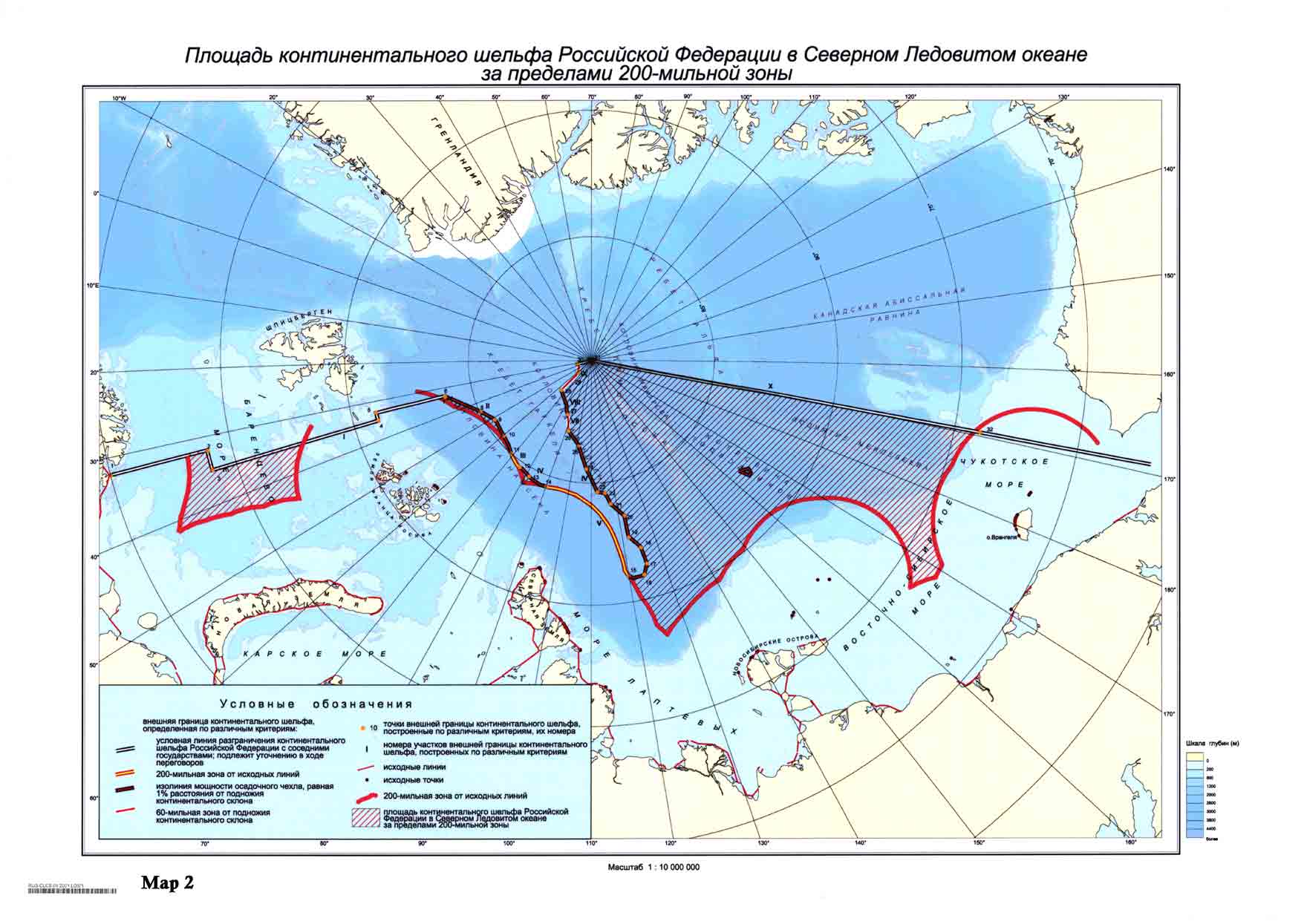
Audience publique tenue le mercredi 7 décembre 2022, à 16 h 30, au Palais de la Paix, sous la présidence de Mme Donoghue, présidente, en l’affaire relative à la Question de la délimitation du plateau continental entre le Nicaragua et la Colombie au-delà de 200 milles marins de la côte nicaraguayenne (Nicaragua c. Colombie)